EARTHSCI 3210/5210 Meteorology
Spring 2016
Professor Alan Czarnetzki
Weather Briefing Resources The American Meteorological Society
Other Briefing Resources Curricula Guide Journal Online
STORM Forecasting Exercise AMS Policy Statement on Bachelor's Degree
Model Display Resource Model Documentation The National Weather Association Central Iowa Chapter
Current Weather Conditions at UNI IA Mesonet Air and Waste Management Association
NCDC State of the Climate CPC Outlooks Significant Opportunities in Atmospheric Research and Science
November 1998 Midlatitude Cyclone National Hurricane Center
Glossary of Meteorology Smithsonian Meteorological Tables, 1918 edition
International
Cloud Atlas e-Journal of Severe Storms Meteorology
--------------------------------------------------------------------------------------------------------------------------------
NY Times Essay: The Weatherman Is Not a Moron (Original)
Climatology: ALO MCW DSM OTM CID DBQ MLI BRL SUX
MSN MKE EAU FSD HON MHE TOP CNK STC MSP STL COU JEF UIN
Persistence: Hourly Reports for Iowa in table format; from within the map, click on station of interest Backup site for ALO
Other States (select graphical option after state name)
Hourly
Reports for
University of Wyoming has detailed hourly reports in UTC Maps of ‘Overnight Lows’ and ‘Daytime Highs’
Lab 1 Resources:
Time UTC Time Conversion Table Online UTC and local
time clocks Common Wind
Directions Temperature
Conversion
ASOS
sites: State
Maps Listing US map
Site Info
METAR Identifiers Quick Reference for
Decoding METARs
FAA
Surface Weather Observations Manual
METAR
Handbook
ASOS
User’s Guide - 1998 Appendices
NWS Reference Guide - Equipment Fed. Met Handbook No. 12 WBAN Numbers Station Networks from
IEM
NCDC Observation
Record Common abbreviations used
by the NWS – go to p. 8
METAR data: University of Wyoming
Lab 2 Resources:
Present Weather
Symbol Chart Abbreviated Weather Symbol
Charts: Version 1 Version
2
Interactive Contouring
Resources: Sea
Level Pressure Temperature
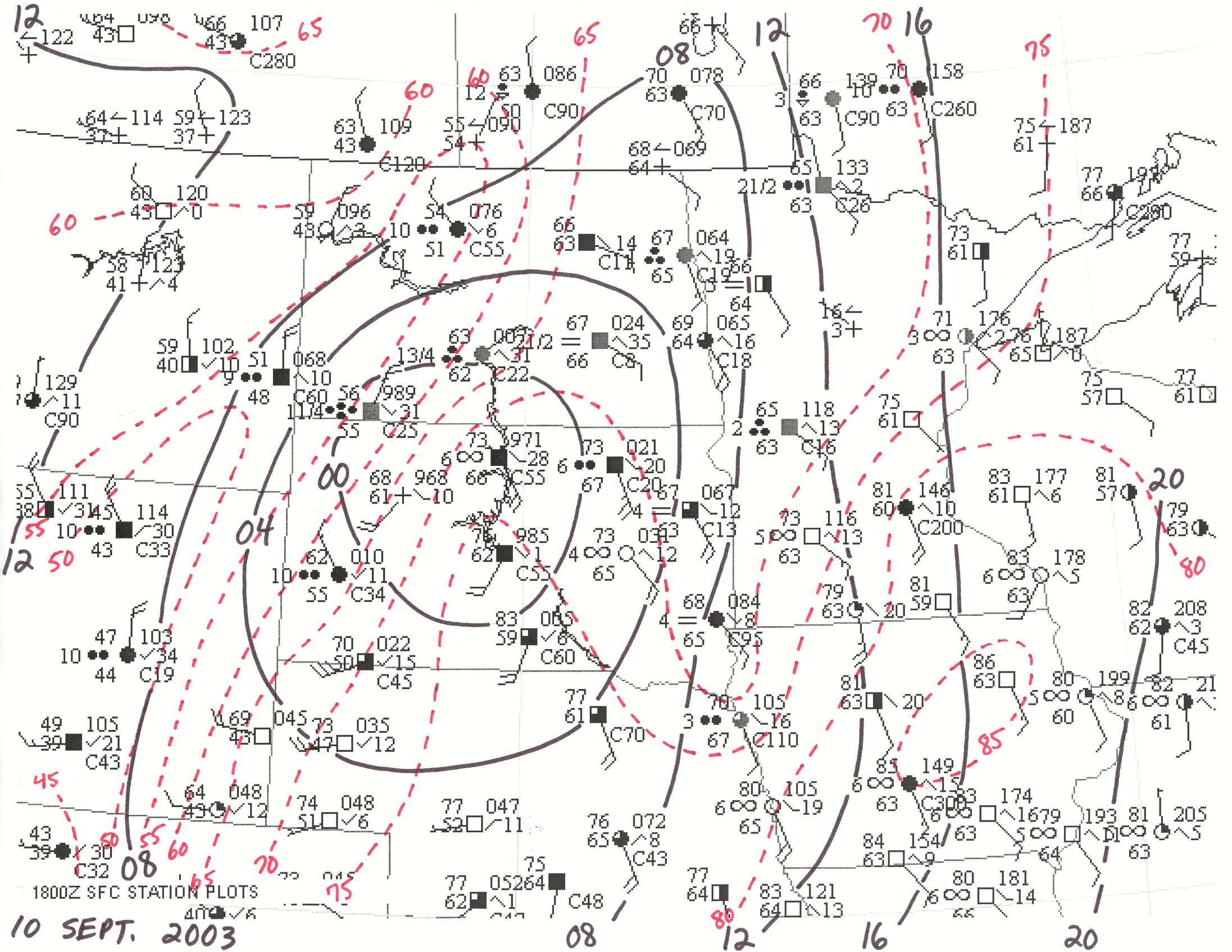
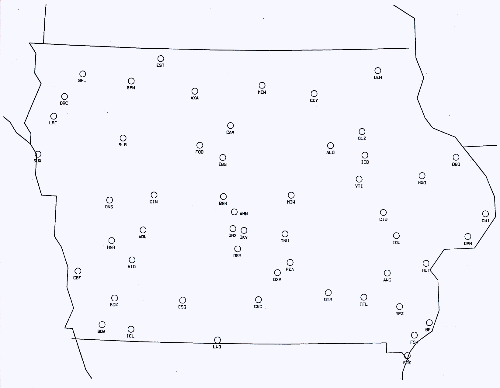
Sample Surface Analysis Iowa Surface
Weather Plotting Map
HPC Surface Analysis
Products HPC Surface Analysis/Radar Loop
Surface Analysis Archive NCEP Daily Weather Maps 2003 to Present Make Your Own Plots
Local Climatological Data
Unedited LCDs
Additional Surface Plots and Maps:
use the “STORM Forecasting Exercise” link above; then go to links
under Surface Maps and Surface Observations
Lab 4 Resources:
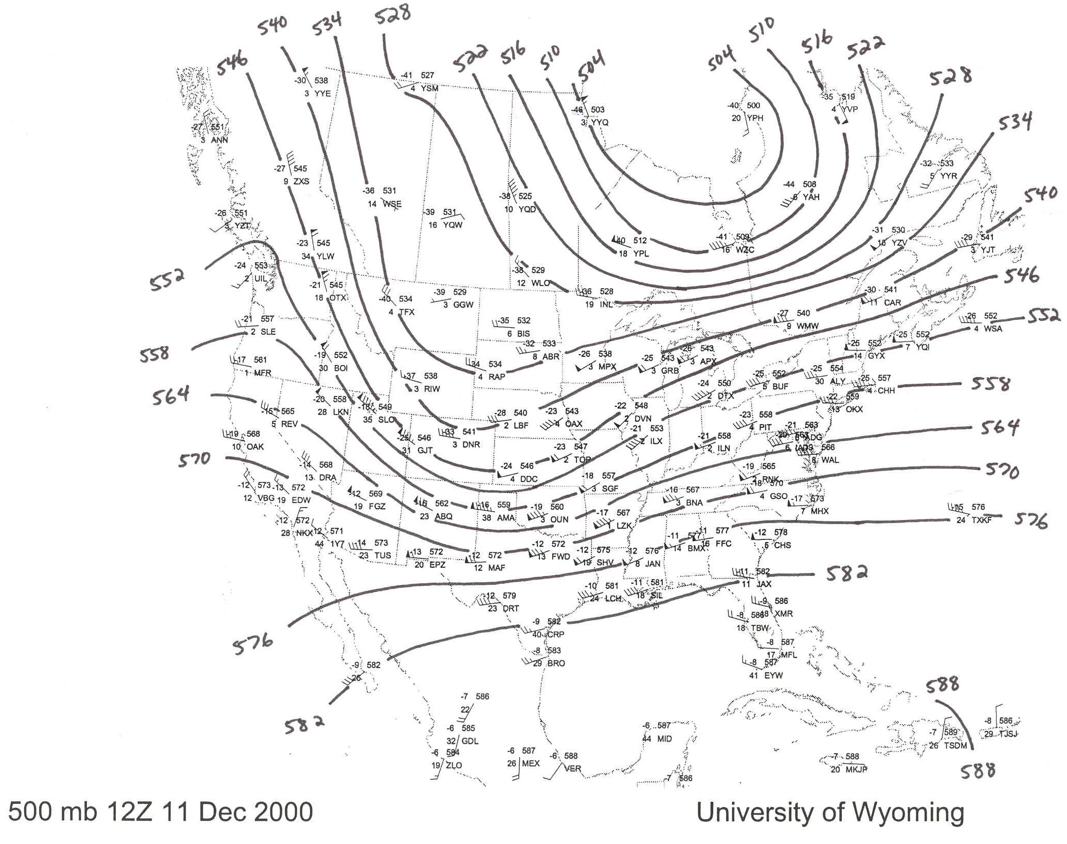
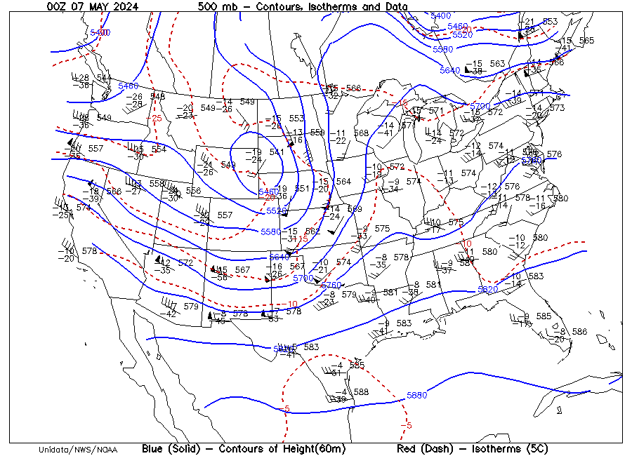
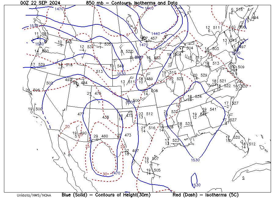
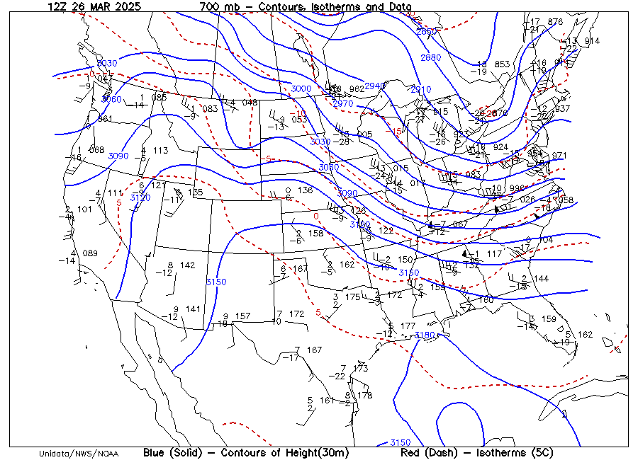
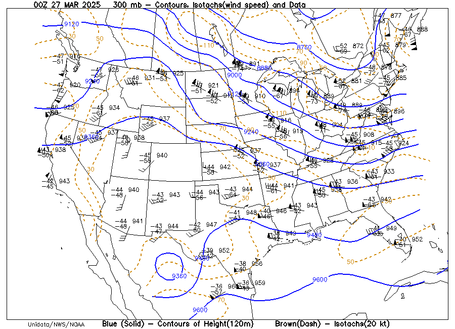
Fed. Met. Handbook No. 3 Sample 500 mb Analysis 500 mb Chart
(Problem 1) 850 mb Chart
(Problem 2) 300 mb Chart
(Problem 3)
Upper Air Plots and Maps: P500-00Z P500-12Z P850 P700 P300 College of DuPage NCAR RAP Site University of Wyoming
Lab 6 Resources:
METAR data Make Your Own Surface Weather Maps Surface Analysis Archive Make Your Own Upper Air Maps
Local Climatological Data
Unedited LCDs Iowa Weather History
Lab 7 Resources:
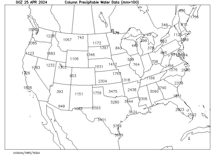
Precipitable Water Forecast and % of Normal SPC Upper Air Climatology DataStreme Precipitable Water Plot (divide by 2540 to get inches)
Real-Time Precipitable Water from SuomiNet Satellite
Derived Total Precipitable Water
Lab 8 Resources:
Images and Links for Lab 8 NOAA Radar Operations Center Volume Coverage
Patterns
Dual-Pol.
Training Modules: An
Overview of Dual-Polarization Radar Technology for Non-Meteorologists Who Use
WSR-88D Data
Hydrometeor Classification Algorithm Best Uses of the New Dual-Polarization Precipitation Products
Lab 9 Resources:
SkewT Diagram SkewT Diagram – printable version
Current Soundings: SkewT Diagrams from College of DuPage SPC Sounding Analyses UNI’s Radiometer
Forecast SkewTs: All models, one time One model, all times SPC Convective
Outlook
Lifted
Index and K Index Map K
Index Image (no map) Severe
Weather on April 13, 2014
Lab 12 Resources:
Annual U.S. Killer Tornado Statistics Monthly and Annual U.S. Tornado Summaries Extra Annual Tornado Maps 2013
Surface Analysis Archive SkewT Archive Make Your Own Upper Air Maps
Storm
Prediction Center - Current and Archived Data Thunderstorm Outlooks Mesoscale Discussions Convective Watches Storm Reports
Lab 13 Resources:
Current
Weather Conditions at UNI
NOAA Solar
Calculator
UNI
Web Cam View at 1 p.m. on April 12, 2016
GLOBE Aerosols Investigation: Protocol Preparation
Guide
Field
Guide
Data
Sheet
Not
needed for the lab, but may be useful:
Time of Sunrise
and Sunset Solar Position
Calculator
Surface Radiation Data from
NOAA Iowa
Radiation Data (Archive)
US Climate Reference Network National Solar Radiation
Database
Aerosol Robotic Network
(AERONET)
Lab 15 Resources: